The SMPG is a powerful analytical tool designed to monitor the progression of the rainfall season by blending rapidly updated station observations, gridded rainfall data, and forecast information. To ensure seamless integration into existing workflows, the SMPG is designed as a plugin for QGIS. It utilizes time series data extracted for each polygon, making it an intuitive addition to GIS-based monitoring and analysis systems. The SMPG tool is designed to work with the outputs of the GeoCLIM, which is also available as a QGIS plugin. The GeoCLIM can be used to generate Improved Rainfall Estimates (IRE) by blending satellite-based gridded datasets with meteorological station observations. Users can also input time series data into SMPG from their custom workflows.
The SMPG Objective
How the SMPG Works
- Current Dekad/LTA Pct.: the percent of average of the long-term average (LTA) for the accumulated precipitation from the Start of Season (SOS) up to the current period (e.g. current dekad).
- Ensemble Med./LTA Pct.: the percent of average for the EOS median value of all possible outcomes compared against the long-term average (LTA).
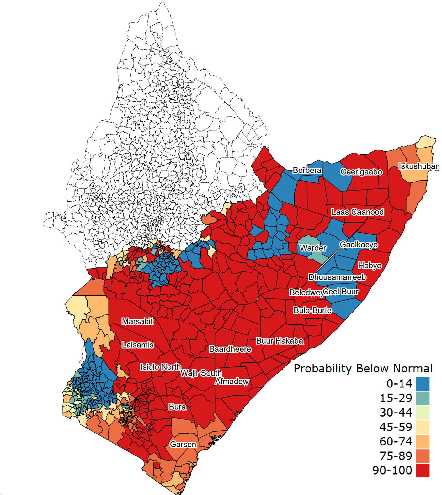
- Probability Below Normal: the probability of the season ending below normal (<33rd percentile).
- Probability Normal: the probability of the season ending normal (between the 33rd and 67th percentiles).
- Probability Above Normal: the probability of the season ending above normal (>67th percentile).
- Ensemble Med. Pctl.: the percentile rank of the median value of all possible outcomes at the End of Season (EOS).
- Current Season Pctl.: the percentile ranking of the seasonal accumulation of rainfall from the SOS up to the current period, based on historical data.
- C.Dk. + Forecast/LTA Pct.: the percent of average of the accumulated rainfall from the SOS up to the current period, including the forecast.
Example
 |
 |
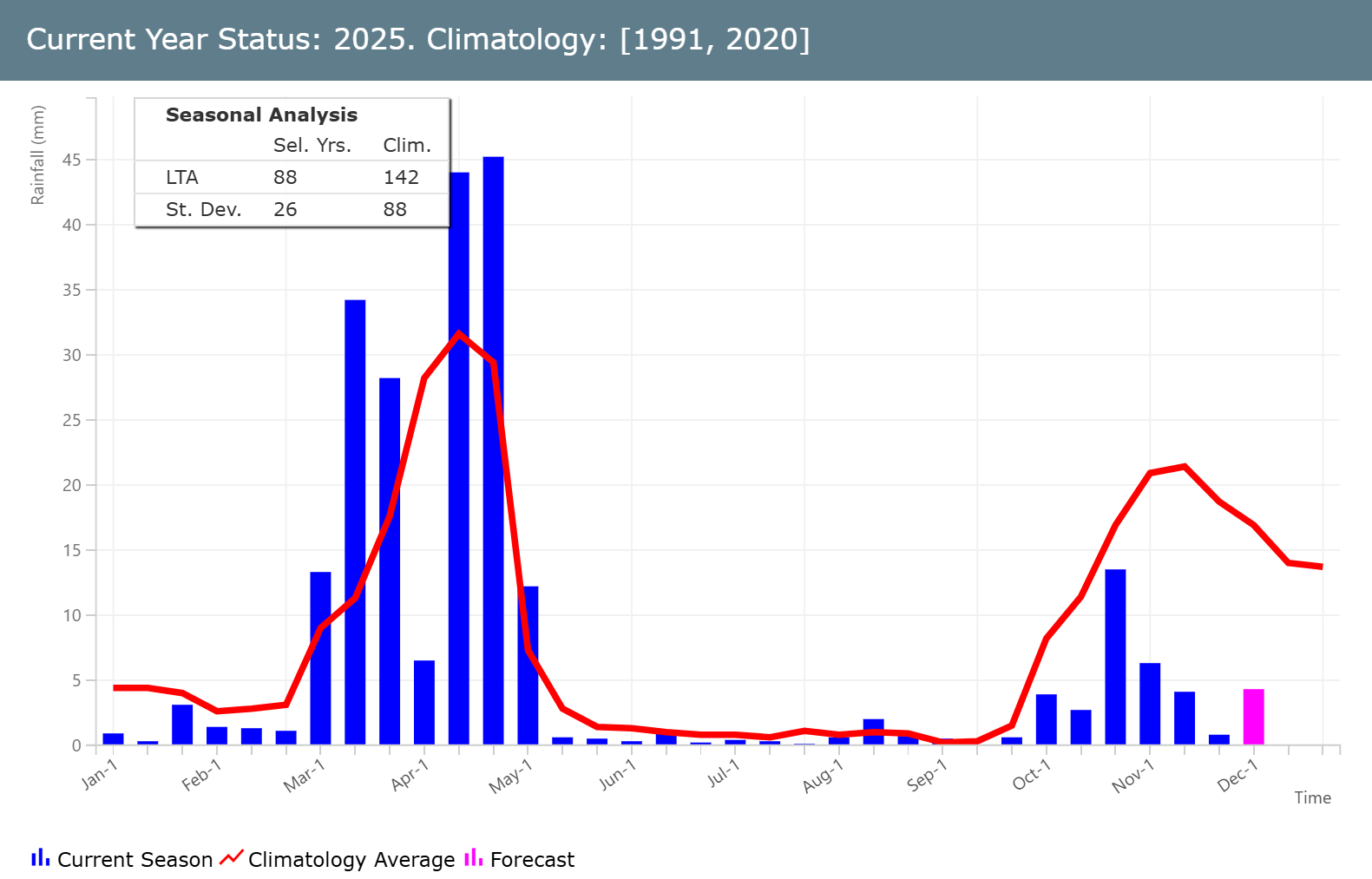
Fig. 1. A map of East Africa showing the probability of the 2025 October-December rainfall season ending below normal (left) and IRE seasonal rainfall accumulation in Isiolo North (Kenya) from the start of the season to the November dekad 3 plus forecast (right). The blue bars show the dekadal rainfall accumulation, the red line shows the long term average (LTA) and the purple bar shows the rainfall forecast for the next dekad.
The QGIS SMPG tool plugin and installation guide can be found here.
Video Tutorial: Youtube
