Bio:
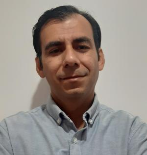
Mario Rodriguez has been working with GIS from 1999 to present. His experience is oriented towards the use of GIS to perform analysis and create information for decision-makers. He has worked for Non-Governmental Organizations and for both the public and private sectors. From 1999 to 2003, Mario worked using GIS to perform Risk Management. In 2000, Mario participated in Regional Action Program For Central America (RAPCA), completing a three month training in "Application of GIS and Remote Sensing to the Analysis of Hazard Vulnerability and Risk" in The Netherlands, sponsored by the Faculty of Geo-information Science and Earth Observation (ITC) and UNESCO. From 2003 to 2007 Mario worked on a GIS application for public and private sector use. Mario worked on the national (Guatemala) and regional geographic data set production. In 2007, Mario began work in the Mesoamerican Food Early Warning System (MFEWS), starting as a Field Scientist in 2008. His work focuses on build capacities in the Met Services and Ministries of Agriculture for use in rainfall model and crop monitoring development by FEWS NET projects. Mario has been collaborating with the Climate Hazards Center since 2007.
